Property Line Guide
Property Line Guide for Engineering: Boundary-Aware Project Kickoff

Most property line decisions fail at the same point: assumptions are made before evidence is organized. With Find Property Lines, Engineering Teams can move from rough boundary questions to a documented process that supports better decisions.
This article is about property line workflow for engineering projects. You will see how to review parcel context, test assumptions in the field, and prepare survey-ready notes before any legal or contractual decision.
Start on the desk, not in the field. Match line turns to deed, plat, or bearing notes and flag language you cannot confidently interpret. This creates a clear first-pass map interpretation you can test instead of defend.
Then move to practical validation. Use visible cues to test whether deed logic appears consistent with site reality. The objective is clarity, not certainty claims.
Why This Matters
Skipping deed and bearing checks often hides the exact segment that needs expert attention. For Engineering Teams, this matters because you can reduce redesign risk by surfacing boundary constraints before layout decisions harden.
A repeatable workflow improves communication across brokers, neighbors, engineers, title teams, contractors, and survey professionals who all need the same factual baseline.
Use Case
Engineering Teams
Boundary-aware site kickoff and constraint identification.
- Screen boundary context before concept layouts and site assumptions.
- Flag line segments that may affect easements, setbacks, or access.
- Package map notes for survey and permitting coordination.
How This Works in the Field
An engineering team screens corridor options, isolates a high-risk edge, and requests targeted survey scope early.
Deliver a clean list of uncertain calls and corner references for professional interpretation. Early clarity cuts rework through permitting and construction planning.
Before acting, build one evidence packet that combines map screenshots, dated notes, and unresolved questions. A single packet prevents rework and keeps everyone aligned on what is known versus what still needs confirmation.
When This Property Line Workflow Is Useful
- Screen boundary context before concept layouts and site assumptions.
- Flag line segments that may affect easements, setbacks, or access.
- Package map notes for survey and permitting coordination.
- Cross-checking property line map direction changes against deed descriptions.
- Preparing a cleaner handoff package for survey professionals.
Step-by-Step Property Line Process in Find Property Lines
- Open Find Property Lines, search the parcel, and mark boundary segments tied to project constraints.
- Map each line segment in sequence, then align direction changes with deed or plat language.
- Highlight any unclear bearings, calls, or corner references for professional review.
- Save screenshots and notes so your property line assumptions are transparent and auditable.
- Before any legal or contractual action, hand off the file to a licensed surveyor.
App Interface Preview
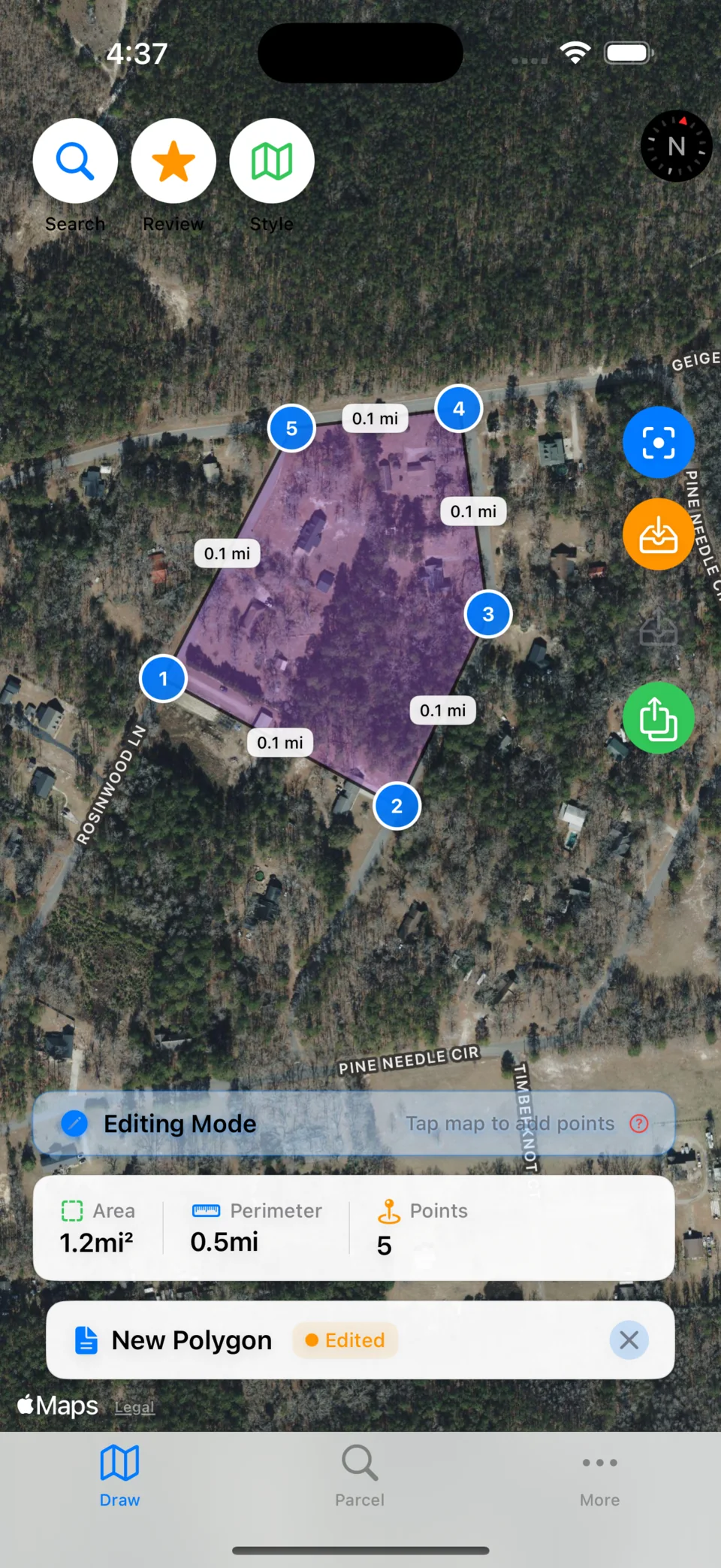
This is a real screen from Find Property Lines used in property line workflows for Engineering Teams.
What to Collect Before You Decide
- Parcel overview image showing the full boundary context.
- Segment-level screenshots for corners and direction changes.
- Field note log with dates, observations, and confidence flags.
- List of unanswered questions for title, survey, or local professionals.
- Decision-impact summary describing what can proceed now and what must wait.
Property Line Verification Checklist
- State the decision tied to each note (offer, layout, fence, permit, valuation, routing, or stewardship action).
- Capture at least one full-parcel screenshot and one close-up screenshot for every uncertain segment.
- Cross-check line turns against parcel context, imagery, and available deed/plat references.
- Record corner observations with time, position context, and confidence level.
- Flag every unresolved segment before permits, contracts, fencing, construction, or closing.
Decision Moments That Need Extra Verification
- Deed calls are ambiguous or conflict with map interpretation.
- Bearing sequences break at one or more segments.
- You need defensible interpretation for planning or valuation.
Common Mistakes to Avoid
- Treating one map trace as final instead of documenting confidence and uncertainty.
- Skipping cross-checks between parcel layers, imagery, and field observations.
- Making improvement, pricing, or contract decisions before resolving high-risk segments.
- Collecting screenshots without linking each one to a specific decision question.
- Escalating too late, after timelines and budgets are already committed.
Where Professional Survey Confirmation Is Required
- Find Property Lines is designed to speed up planning, measurement, and documentation workflows.
- Parcel layers, imagery timing, and GPS behavior can introduce offsets in some locations.
- Final legal boundary determinations and formal dispute outcomes require licensed professionals.
For legal boundary determinations, disputes, permits, and title-sensitive decisions, consult a licensed land surveyor and local professionals.
FAQ
How does Find Property Lines help with property line work?
Find Property Lines helps you search parcels, measure and compare candidate boundaries, and organize notes/screenshots so every boundary question is explicit before you spend on field work.
Why can a property line map differ from what I see on the ground?
Map imagery dates, parcel data quality, and GPS variability can create visible differences. Treat mismatches as verification signals, not final conclusions.
When should I bring in a licensed surveyor?
Bring in a surveyor when decisions affect contracts, permits, setbacks, legal disputes, or final boundary placement. Your app notes make that handoff faster and clearer.
What if deed language is unclear to me?
Capture the exact language and segment in question, then hand it to licensed professionals for interpretation.
Continue Reading
Property Line Guide for Engineering: Boundary-Aware Project Kickoff
Engineering and site planning workflows with boundary context before field execution.
- Property Line Map App for Engineering Teams: Marker and Corner Field Prep
- Property Line County Map for Engineering Teams: What the Map Can and Cannot Prove
- Property Line Dispute Prep for Engineering Teams: FAQ and Next Steps
- Property Line Guide for Landowners: Fence, Corner, and Neighbor Checks
- Property Line Guide for Real Estate: Listing and Buyer Boundary Context
- Property Line Guide for Appraisers: Map Context for Valuation Work
Try Find Property Lines on iPhone
Use map-first boundary notes to reduce rework during survey and permitting phases.
Disclaimer
This content is for general educational and planning purposes only.
Find Property Lines does not provide legal advice, cadastral determinations, title opinions, engineering certifications, or licensed land-survey services.
Map overlays, parcel layers, imagery, and GPS-based measurements can contain errors, offsets, stale data, or omissions and must never be treated as legal boundary proof.
You are solely responsible for verifying all boundary, ownership, permitting, tax, zoning, and contractual decisions with licensed professionals before relying on any output.
To the maximum extent allowed by law, we disclaim warranties and liability for direct, indirect, incidental, consequential, special, or punitive damages arising from use of this content or app output.